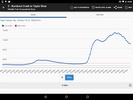
Discover RiverApp - River levels, the comprehensive guide to river levels and flows across the USA and in over 20 countries worldwide. With more than 40,000 hydrometric sites integrated into its database, this app serves as an indispensable tool for enthusiasts and professionals engaging in a variety of river-related activities, such as kayaking, canoeing, pack rafting, stand-up paddling, fly fishing, river surfing, as well as for those in sectors such as hydroelectricity and irrigation. It is also invaluable for flood monitoring and response.
Unlock free access to current data for over 15,000 rivers, including water temperature readings, and tailor the platform to individual needs with personalized alerts when water levels at chosen stations reach critical points. With the ability to favorite stations and whitewater sections, users keep vital information close at hand. Additionally, detailed maps and whitewater sports features like navigability indicators, put-in and take-out point mapping, hazard reporting, and route information enhance the on-water experience.
For a more in-depth analysis, the Premium version offers historical data, predictive flow and level forecasts, and satellite image comparisons. The platform sources its rich datasets from a variety of reputable institutions including the USGS, NOAA, and several international hydrometric data providers.
Stay informed with up-to-date, reliable river condition information, and ensure users are well-prepared for their next aquatic adventure or professional undertaking. Download the game to gain an edge in river activities and ensure safety with the most extensive river monitoring network available.
Requirements (Latest version)
- Android 5.0 or higher required


Comments
There are no opinions about RiverApp - River levels yet. Be the first! Comment